County Tops
Number 19: Black Mountain (Twyn Llech), Herefordshire 16-03-2025, 703m
Walk technicalities *** (extra * due to weather)
View **** (Losing a * due to clouds)
Company *****
Overall 10/10

My best friend since Uni. and always a great walking partner. I had a 3.4km walk with Honey before hand, then drove 2 1/2 hours up to see him. A further two hour drive from his place, (avoiding potholes) and we arrived at the car park at the bottom of Black Hill (yes, that one) Here we had 30 seconds of looking at the map and checkinh we had the right hill, as Black Hill is a spur of the Black Mountain range. Nope, we needed Black Mountain, in fact Twyn Llech, which sits right on border with Wales, a few km on up the ridge! Oops. Oh well!

Half these photos are Steve's.

Black Hill has (despite the slipperiest start eveer, face planted in rather fun way) has a rather superb ridge that narrows quickly. It's a bit of a pull but it quickly became apparent it was going to be worth it.
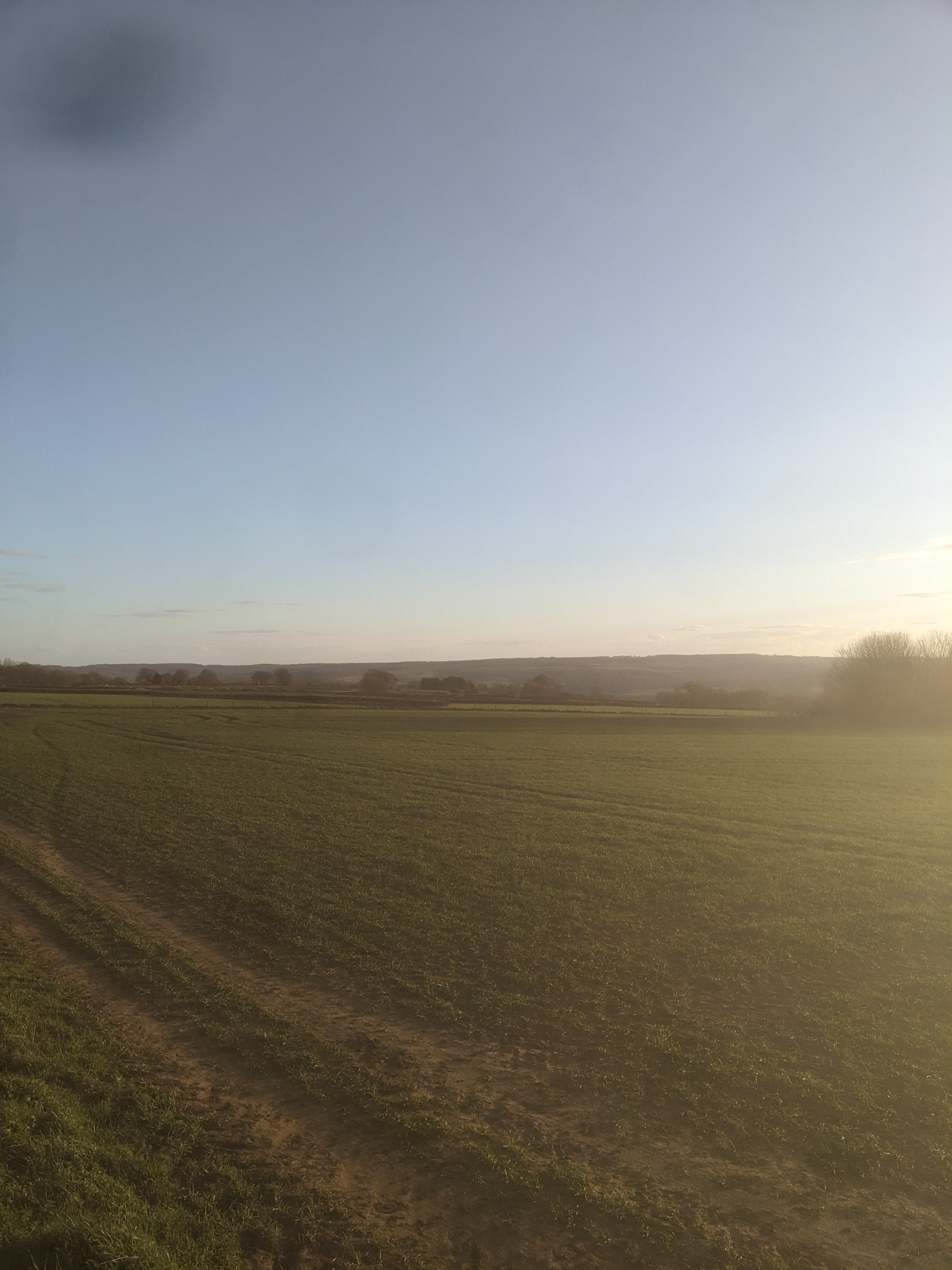
It gets quite narrow,and on a clear day, the views would be surely be awe inspiring!

With the wind, it certainly made it more of a challange. It was blowing in on our left for Black Hill, in our faces up the coll to Black Mountain, and in our right ears all the way along the ridge.

The ridge is clearly marked with cairns along the way.

Black Hill has a proper trig point, so fun ensued

Not often you meet a Trig Point with a moat!

Good swimming Steve!

We then dropped down to the coll between the two, and walked along North West around the flank of Black Mountain (Twyn Llech) almost to Hay Bluff , before swinging south towards Black Mountain (Twyn Llech) proper on the Offa's Dyke path.
 ,
, To be fair, there has been a lot of work done up here. Last time we were in the area, the path to the south had been quite a slog through peat bog, and was spreading out for metres across the hills, and as you can see, the flags allow the surrounding peat bogs a chance to recover and stabalise, and maybe in a few hundred years, regenerate.
Heading up to the summit.

Steve, unknowingly, on or near the summit of Twyn Llech,

Looking back

And then onto South Summit of Black Mountain, which I had thought to be the highest point in Herefordshire until I checked my facts.

Which is marked by a small cairn, a very small cairn.

Me at the top of the South Summit

With Black Hill and Twyn Llech behind. The gloves in my pocket really don't do anything for my frame!

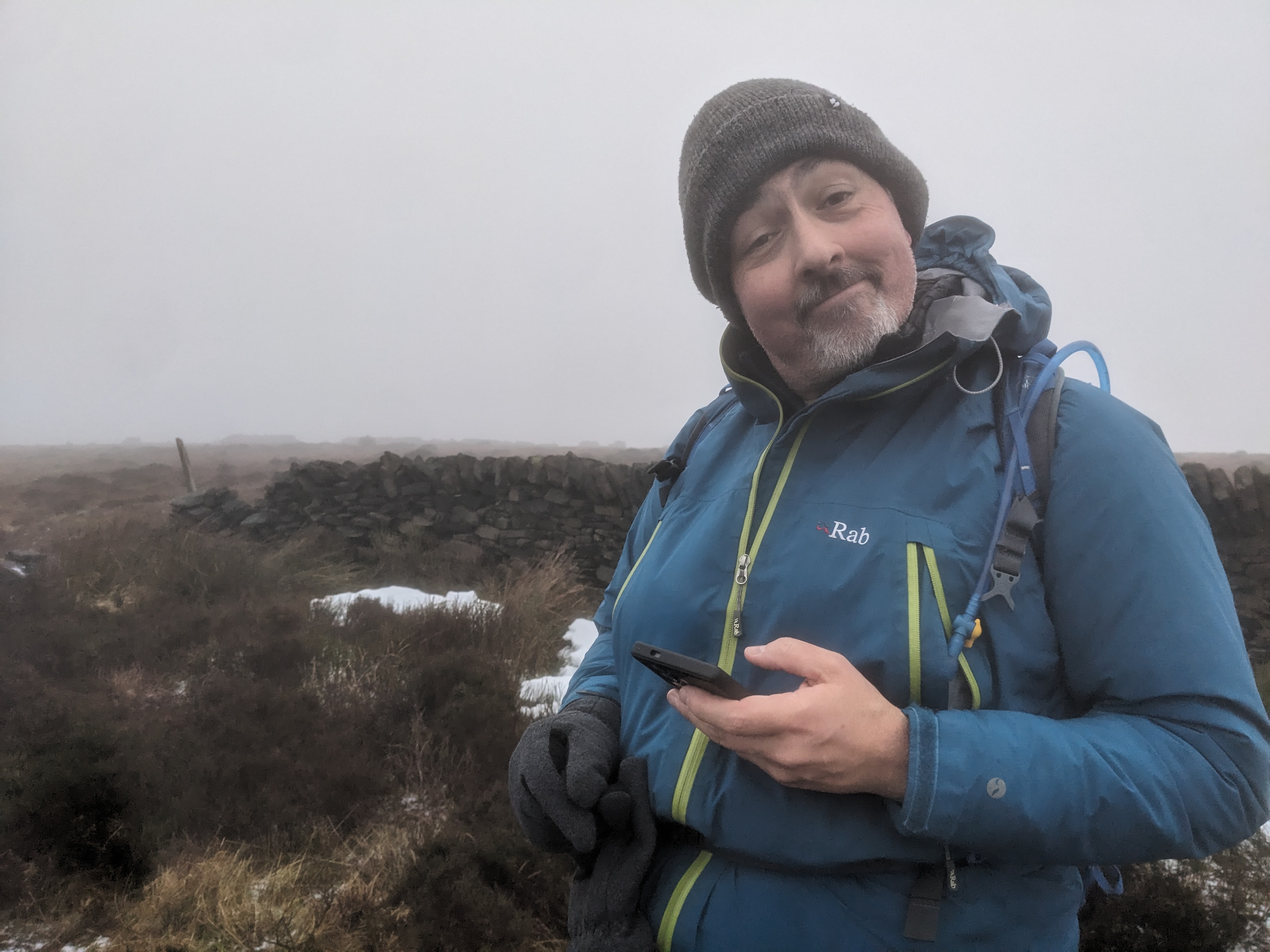
A happy, if windswept, Steve.

As we dropped off the ridge, we realised we had done this bit before. Back in 2000, Steve and I had walked as far as this point from the South, a good 60 miles, when we had started at Chepstow, but Steve's knee had played up, I was out of shape, and we did not get any further (although I did have a glider flight that week too, so I needed to get home, plus Steve had time to spend with Rosie).

Snack time

Where we had stayed the first time we came off the Dyke, Step-Grandad in Law's place! Owain Glyndŵr maybe once stayed here. We weren't staying this time though.
 A long hop back to Bewdley, and the next day, Steve and I had a couple of trip points in Worcestershire to bag.
The first was Broomhill, which did have broom on it.


Then Lickey Hill, with a folley! Birmingham behind.


Trig selfie, then home. 
Number 16: Billinge Hill, Merseyside 24-02-2025, 179m
Walk technicalities *
View ****
Company *****
Overall 9/10


The view from teh top is a proper 360 of Merseryside, Manchester and South Lancs, actually really impressive. Pete and I sent a long time picking out sights, such as Bolton's stadium, the Blackpool Tower, various loclal hills, Wales and more.

Looking North-East towards Pete's stomping ground.

Necromunda - sorry, Manchester Hive city in the distance.

Wales in the far distance.

Number (not counted): Old Man of Coniston, via Dow Crags, Used to be Lancashire, 25-02-2025, 802m
Walk technicalities ***** (Grade 2 scramble)
View *
Company n/a
Overall 8/10
After a night of lasagne, beer, wine, laughs and movies at the Biltons in Lancaster, I headed North to the Lakes, my objective for the day, The Old Man of Coniston via Dow Crags. I always forget how far the eight miles from Ambleside to Coniston takes.
Why?
These were the first Lakeland mountains I had climbed, with Steve, back in 1995. So, thirty years later, how hard could it be? Parked up at Walna Scar carpark, suited up and trotted off down the Walna Scar road.


I then dropped down to the coll between Dow Crags and The Old Man, where I saw the only two other people I had seen since earlier that morning. The ascent to the top of The Old Man involved some map work to ensure I stayed on the path.
This is the traditional top of Lancashire, but now firmly in Cumbria. Visibility was poor, the wind was strong and the rain biting. Here is the summit cairn from aboout 25' away. Felt good to be there, even if it was scary!


Someone bagged one of Graham's tripods here?

Number (not counted): High Spy 26-02-2025, 650m
Walk technicalities * (***** due to weather)
View **
Company n/a
Overall 3/10 (still better than teaching!)

This should have been a breeze, Quick walk round Castle Crag, up Tongue Gill, past the quarries, up to Dale Head Hindscarth and Robinson.
Nope.
The rain was coming down in curtains, when it wasn't coming up vertically the wind was up, the paths was a stream and gully was acting like a wind tunnel. I discovered that losing three stone since buying my waterproof trousers makes them as baggy and an Olympic snowboarders trews, which meant they spent most of the time around my thighs. The path, despite climbing next to a stream, had become a slippery stream. I got to the shelter of the abandoned slate mines, carried on to the fence and then checking my phone, realaised it had packed up, completely - hence the lack of photos! I got to the coll, and after passing one walker, decided Dale Head was too much and went up High Spy instead.
On the summit push, it was so windy, I was blown over, twice (and I am just shy of 15 stone), and got to the summit cairn on hands and knees! I was obvioulsy pushing my luck at this point, so I turned round to descend. At this point, it got even worse! The wind, which had been across me before, was now in my face. It was now tearing at my hat, which I had to hold on, and was so powerful it kept my hood on my waterproof down, and kept forcing my zip of my coat down too! Meanwhile I am having to pull up my waterproof trousers every few steps, keep my balance and descend.
I thought conditions might ease in the gully, but it had turned into even more of a wind tunnel. I fell twice more on the descent, once impacting my right hand little finger as the first point of contact, which bruised it nastily, if not dislocated it, but the next fall appeared to have reolcated it! It still aches now, 10 days later.
Wet, phoneless, disappointed not to have got to my targets, I retuned with increasing happiness to the hostel for warmth, shelter, beer, food, the kindness of strangers who allowed me to use their phones to see if I could fault find mine, and a sense of relief that I had survived that one. Phones are replaceable, adventures aren't; and we all know a good tale features the words "No shit, there I was, thought I was gonna die..."
Two days for two of that so far then! Genuinely one of the worst days on the hill ever, but mam it's made for good tales since.
The phome was utterly kaput, so the next two days photos are courtesy of Mike, who arrived with Craig just before lock up time at the hostel, but in enough time to sink a pint or two.
Number 18 : Scafell Pike, Cumbria 27-02-2025, 978m
Walk technicality ***
View *****
Company 10/10
Overall 10/10

THE BIG ONE!!
The highest of all the English County Tops. One I had been pondering about when I would be doing it as it would be a great finale, but Mike and Craig were both free, and were willing to put up with my company for a few days. So, hell yeah! It was honestly an honour to be in their company, as experienced walkers and outdoorsmen, great conersationalists and some of my oldest friends. Plus I learned a new swear word.
We set off in calm sunshine.
I know.
Walking in to Seathwaite and Seatoller, it could not have been better. Glamemara welcomed us.

With our target in sight, we stopped for a chat and refuel. It felt like we had already done a lot of up, but this was only a tiny fraction of it. Heading up to the pass at Esk Tarn

New stretcher box at Esk Hause, Craig looking buff.
Lingmell stands behind us. There was a possible 'side bag' of it, but we decided against.

We headed up the Corridor Route, hit the Lingmell Coll and then pushed up to the summit. Snow on the top had almost gone.

As we hit the top, County Top 17, Sacfel Pike, Cumbria, done.
The cloud came in, but we did not care, we had done it. It was just below summit height, and quick enough to see the massive views in all directions. Views I will not forget in a hurry. Mike, being a sensible chap, does not fill his camera roll with such fripperies. But he does take an AMAZING selfie on the summit platform.

Our descent route over Great End, Borrowdale and the bar enticingly in the distance. We had last all been up here in the 90s, as I hardly get to the Lakes, while the boys have been concentrating on different projects.

Great End from below as we started down the Ruddy Gill path (never used it before, good descent route).

The long trek back to the hostel once we were down on the flat, was greated by red skies over the peaks, it was awesome, but never photographs well. Many km walked, many 1000 m ascended, many 1000 calories burned, many ribs aching from laughing. Honestly, a superb day, and a salient reminder as to why I do this stuff. Company, views, achievement. Just the best. Thank you Craig & Mike, IOU.
Number not counted : Grange Fell, Great Crag, Low Saddle 28-02-2025, 419m, 440m , 656m
Walk technicalities ** (path and peak finding)
View *****
Company 10/10
Overall 10/10

Mike has been collecting The Nuttalls for a while, and Low Saddle was his last one in the Lakes, while Craig is adding all the Wainwrights to Strava. This was their day, and it was great.
First up, not much up, but a great fun hill to play on (floating rocks, natural Henry Moore statues, summit boulders) was Grange Fell. As something to loosen the legs after Sacfell Pike, it was perfect It has three possible summit lumps, we did them, just to be sure.

Then the bog stomp began. It has been a long, wet winter and spring this year, so the ground is a tad moist. The central Lakeland Fells is notoriously boggy, and this did not disappoint. We walked across to Great Crag, which also has two tops, both of which could be considered the summit, so we did both. Both were lovely. Then we went on towards Low Saddle, which, while being a promenence of its own, is often overlooked by its neighbouring Wainwright, Ulscarf.

But it was a great hill to do with these two.

Looking towards High Saddle and Ulscarf. The summit cairn

And as we descended, the sun came out, it was warm, clam, beautiful. We descended back down to Watendlath, in the most georgous light imaginable. That is view to die for.

Pints, a very happy Mike set off home, and Craig and I carried on the game playing marathon. Next day was a grade 1 fester, phone shopping for me, present buying for home, tea shop for Craig (Square Orange in Keswick - REALLY GOOD) catching up with Paul, who I have not seeen in years, and generally having a relaxed time in Keswick and Kendal.
Number 19 : Cold Overton Park 02-03-2025, 197m
Walk technicalities *
View ****
Company n/a
Overall 8/10
Just over a squeltchy km, quite a diversion from the M6 M1 corridor, but worth it.
How can this rate higher than Coniston - well, I didn't fear for my life, I could see the view, and it was fun!
And a Spitfire flew over me.


Interesting dismount hazard.

Only a few meters up, but decent views. 
You can just make out Rutland Water

What a day.

The inevitable near summit telecoms tower and resevoir, and a thumb!

A great week away, planning for next week with Steve for a few more days on the hills. Which ones - TBC!
Three hills in one day. EPIC!
Number 13: Worcestershire Beacon, Worcestershire, 28-03-2025, 425m
Walk technicalities ***
View ****
Company *****
Overall 10/10
Steve and I met up to do the Malvern hills. Which left me with one question...
Why the hell haven't I done this ridge before? It was AMAZING!
Three and three-quarter hours of hills, sunshine, wind, hail, laughs and chat over 17km. Top.


It was quite a view in all directions. Looking North towards the Salopian hills.

The paths were clear and well marked. 
Ste sorts out his kit on the ridge, looking East. 
The legend that is Mr Forth.

The top of the Beacon.

The Troposphere showing what you can see.

Between the hail storms, you can just make out the Wrekin and the Clees on the horizon.
The monument.

Looking along the ridge to the Black Hill and North Hill.

Yes, I did swim the Trig point! Steve has the photo.
Descending down to the Northern end of the ridge.

We looped back round, and this is the half-way point. A rather magnificent bus shelter.

Millennium Hill, looking on towards English Camp or the Herefordshire Beacon.
It
See
Looking back along the ridge. 
There's a really good cafe at the pass, and it's dog friendly.

Monumental masonry on the path to English Camp.

These are some SERIOUS earthworks up here.

The day improved as we went along, although shelter from the wind was great.

Lunch at a reservoir. Great view out over the Severn Valley.

The shadows on the hill fort showing the ditches.

I left ste to head home, and I took a massive detour home to pick off two more tops.
Number 14: Cleeve Hill, Gloucestershire, 28-03-2025, 330m
Walk technicalities *
View ****
Company n/a.
Overall 8/10

One junction of the M50 and a loop round teh M5 and the Hot Air Ballon roundabout (that no longer is), I ended up driving through Cheltenham at school chucking-out time, ot one of my better ideas. But I arrived at the top of a series of interesting and narrow lanes, to
be met with an indecisive sat-nag, that wanted me to cross a ploughed
field to get to the top, even when there was an obvious path!


Oh look, a hilltop reservoir. Not seen one of those in a couple of days.

Maybe the telecommunications masts should have been a clue as to which way was up?

The Trig point on Cleeve Common, on Cleeve Hill. Yes, I did swim it!

Wandering on, I decided not to go straight back to the car, but catch a trail I had seen earlier.

I dropped down a bit, just to see.

Looking North towards the Midlands proper.

The route I had spotted led into an area of older earthworks and butterfly sanctuary.

With the Malverns, this morning's hills, writ large to the West.

"Been there, climbed it!"
Truely windswept trees.

Pretty good views out towards the Severn valley from the east this time.

Looking back down into Cheltenham as shadows lengthend. It was time to head to Warwickshire

Number 15: Ebrington Hill, Worcestershire, 28-03-2025, 261m
Walk technicalities **(second star added for the challenge of finding the top)
View ****
Company n/a.
Overall 6/10
Many don't rate this one, and it's a little interesting. If you purely come to bag the hill, it does nothing. The Trig is seperate from teh actual top, which is in a separate field nearby. Another telecoms tower dominates, and apart from a view West towards the Malverns and North to Birmingham, it could be quite easily written off as a bad hill. So, being bloody-minded, and as this was the last top of the day, I deceided to make something of it after coming all this way to get here. I went for a walk. 
More telecoms...

An interesting path betwn ancient hedgerows. It was lovely. The top is about four meters to the left of the left-hand hedge.

Very, very, very friendly sheep. They came right up to me, demading to know what I was doing here, and whether I was going to feed them.

Told you they were friendly.

In the far distance, Brum. Old paths lead back up to the top.


The Trig point, lurking in a field line.

Sun was dipping down.


Three great hills. 22km walked, 900m of ascent, brilliant.
Number 12: Turner's Hill, West Midlands, 26-03-2025, 271m
Walk technicalities *
View **
Company n/a.
Overall 4/10
The lowest yet score yet, for a real hill, outside of London. But a bad day on the hill is still better than a good day at the chalkface.
Wasn't sure what to expect from this one, as it's in the middle of the West Midlands. But anything is better than sitting in the car on the motorway on the way up to my Dad's. So, a detour and a hill.
You can see the towers from the M6 as you head up to Spaghetti Junction. I have never done this one before, so why not? A quick nip down the M5, a few miles along the Black Country Way, and a sudden left, and skirting round a quarry and a golf club, brings you to this.


No 9 & and 9 and a bit: Silverhill & Newtonwood Lane, Nottinghamshire 24-01-2024 203.6 & 204m.

Walk technicalities both *
View ***/*
Company n/a.
Overall 6.66666/10
Dropped some figures off with Manny at Boards & Swords, then, on the way up to Derbyshire to go walking with Crain, Mike & Kev many others, I took quite a detour to Silverhill and Newtonwood Lane, the two highest points in Nottinghamshire. One is artifical, the other is natural. I went for the artifical first, as it has a car park and a walk.

It's basically the spoil heap for a former colliary. The peak was added to try and make it the highest point. They missed by a few cm.

I arrived as the last of dusk settled.

A very short walk up the mound.

At the top is a statue called 'Checking for gas'.

The view from the top is quite impressive, although you are surrounded by trees, they are lower than the blocks you can stand on.

It's pretty good.

Off towards Alfreton.

The path up.

Looking over his shoulder.

Love this shot
Irony was, I had driven past this on the way to Silverhill. Newtonwood Lane is just a road, and there's a tiny laybye, and the second hilltop resevoir, so the actual top is inaccessible. The walking for this was crossing the road, and just checking there was no way round it. There wasn't.

There was a view, but not much of one. The pylon was impressive.

Looking down towards Tibshelf and the M1.

Walk technicality **** (winter conditions)
View - cluds were down
Company *****.
Overall 10/10


I was joined by Mike, Craig and Ollie. Craig and Mike hae both done this route before. Ollie, despite being a long distance cyclist, was meeting Type 2 winter hill fun for the first time.

It was a short walk, across ice and snowy moor, to the corner of the wall on Cheeks Hill.

Looking back, the road is 1/2 a km away, but you could not see it.

Ollie enjoyed it!


We did that!

We then all drove the short hop to the Cat and Fiddle, and got ready to do Shining Tor. First of the top 10.

Well, we weren'y expecting this!

A touch glassy underfoot.

Mike looking happy.
The trigpoint.

Selfie time!

Ollie on his way back.

The trig.

And if there is a trig, this has to be done on it! Great shot Ollie!

Another great shot by Ollie.


County Tops No 7 & 8: Great Crishill, Cambridgeshire & Chrishill Common, Essex 12-09-2024 146 & 147m.
Walk technicality ** (second star, mostly because we didn't take a map)
View ***
Company *****.
Overall 10/10
Two for one!
and not just Ed and I in the car on the way. These two peaks are within half a mile of each other, and while two of the lowest on the list, were a good day out exploring.

Ed's version of the map, because I accidently forgot to restart the app.

It had hammered down the day before, but the Thursday we set off was lovely and warm. First thing I realised upon arriving in the lovely village of Barley, was that is was where my friends Louise and Michael had got married nearly 15 years ago! It was also in Hertfordshire, so we crossed three county boundaries on this one.

Plus the Fox and Hounds had interesting street decor.

We went the wrong way, but the houses were pretty!

Back we went. The front of the Fox and Hounds, there's a theme here!

Leaving the village, a small dip and out of Hertfordshire towards Great Chiswell Windmill. Hertfordshire's peak awaits, it's a long way from the east of the county here, and will be another time...

Out we go.

And into Cambridgeshire...

Great Chiswell Windmill

Ascending past the mill to the pass a rather fine church.

Past them, and through a field, the highest point in Cambridgeshire just outside is a reservoir

No trig, but a mussy field.

Crossing into Essex, the highest point lies beyond yonder copse, past that dip which separated the peaks by a goodly 25m..

It doesn't look much, but on the woodline is the highest point.

Somewhere here?

I dove into the wood, as the map was pointing somewhere in there, and Ed made a perfect pose, like he was balanced while alighting on this branch!

It's here!

Wood

Looking back to Cambs.

It's a good boundary.

We walked round, and headed back to Barley, via Little Chishill, and a slightly amusing...

So, no real ascent, but two counties but an absolutely lovely walk and a fab day, with great company and lots of laughs about life, family and friendship. A brilliant day all round. We repaired to the Fox & Hounds for a lemonade before heading home.
County Top No 6: Milk Hill, plus Tan Hill White Horse, Wiltshire. 21-07-2024 295m.
Walk technicality **
View *****
Company n/a.
Overall 10/10

After a fun weekenmd of wargames and crashing at Nigel's, I came 6th out of 16, and was rather pleased with my results, I decided to take a slight detour on the way home and pick off the highest point in Wiltshire, Milk Hill, plus a bit of Tan Hill and it's rather magnificent White Horse.
The approach is via a long. mostly unpaved, track, which has it's own paypal QR code. It's a good mile or so along this track, shared only by horse riders when I went up, which takes you to a carpark nearly at the summit, with Wans Dyke on one side, stretching off.
Milk Hill rests behind these two, on the right. Like a nice, lurking hill. 
These hills are old. It's on the chalk, chalk has bones in it...
Parking the car up, the landscape was ancient, with trackways and ditches crisscrossing the area.
Looking North West over the hills, all the way for miles.
As far as carparks go, it's quite spectacular.
Over a stile, and following the edge of the ridge looking towards Clifford's Hill and it's magnificent hillfort.
Damn great lumps of stone, sitting in a circle on the edge, these were field clearence stones, not anything majorly historic.
It's a wildlife preserve, with orchids.
Following the edge round towards the White Horse. 
The head and eye of the horse. You can walk all the way around it, but I did not fancy it in Tevas, so I went down under the head and a leg.
It's quite a gradient.
I then went back up onto Milk Hill, following coordinates, to find the highest point. It's only 26cm higher than Tan Hill, and the spinny makes it look higher.
The view from the very top was jaw dropping. Not sure how far, or how many counties you could see, but it was worth it!
It was great.
The crops had been closely harvested, but there were enough trails to follow easily.
A great hour, really loved this one.
County Top No 5: Uffington Hill, Wayland's Smithy, Plus the White Horse. 06-06-2024 146m.
Walk technicality *** (actual map used)
View *****
Company 10/10 - walking with Ed.
Overall 10/10
A lovely sunny June day, Edward and I were both off work, and I had been batting this idea around for a while, and finally we went for it.
We parked up in the village of Woolstone, nestled below the ridge. A short trek across some fields, with lovely cows, we started to ascend. On the way out of Woolstone we came across this impressive war memorial to those who served from the village in WW1, thirteen served, two fell. 1/7ish, that's high.
We headed up a concrete track, with great views over the Vale and Swindon! 
The slopes have these great features, we were trying to work out whether it was natural terracing of a geological feature of erosion of the chalk.
Our first port of call upon reaching the ridge,and trotting along the ridgeway for a few minutes was the incredible Wayland's Smithy. As far as long barrows go, this was incredible. 5500 years old. 
The approach. Mystical, maybe, but impressive.
From the back, looking North
A six foot plus Ed, next to the front for scale. The man hours to build this must have been astronomical! Especially pre the invention of the wheel. 
A view inside, you can just make out the side chambers.
Just look at the size of these things! 
Didn't quite work, but this was a Greater Spotted Woodpecker feeding its young in a nest!
After a lunch, we returned to the Ridgeway, and found a nearby spinney with great perspective.
Further up the ridge, starting to ascend the ramparts of Uffington Castle, looking East. No one was sneaking up on this place in a hurry!
The rampart, with the inner full of wild flowers.
Impressive acreage. You can see someone on the far parapet.
Double ditch and rampart on the gateways.
In the far distance is the end of the Ridgeway at Ivinghoe Beacon.
Panoramic
The trig point, which, as far as we could tell, was a tiny bit lower than the parapit of the fort.
We think this was higher.
Good init!
Ed summiting.
The trig point.
Point bagged!
Oh yeah, I swam! 
Does it look higher?
The world famous ancient Iron Age Uffington White Horse. From above
Impressive huh?
An orchid!
In fact the whole area was full of them!
This was almost the best view of the horse!
I think you can see a leg, maybe, the back?
The iron age obviously had a good concept of irony, as you can't see the horse from the area!
Edward on descent!
Terracing, really lovely.
It's a good ridge.
There are some beautiful properties in Woolstone!
Is it fox or a chihuahua on that thatch?

That's what the horse was meant to look like!
Lemming-aid and crisps to celebrate. 1/10th of the county tops done!
And then, when I got home, I took Honey out for another 5 mile walk!
Bit different rates! 
County Top No 4: High Holborn, City of London. 19-02-2024 22m.
Walk technicality * (GPS needed to find the actual point)
View *
Company n/a (left the family in Forbidden Planet for ten minutes)
Overall 1/10
Seriously, 22m.
This is the lowest county top, High Holborn in the City of London. (but what about Parliament Hill? Yes, it's higher, but it's not the City ) After a lovely afternoon at the Young V&A looking at the Myth to Manga exhibition, we tubed across to Tottenham Court Road, then popped up like a meerkat along High Holborn. Dropped off the family at Forbidden Planet, set the sat nag. The actual route, such as it is, is flat, urban and although there is some intresting archetecture, it's views are not great. The bench mark is obscured, and the actual highest point is a rather unassuming lump on the pavement. Such is life.Will find something else to make up for it, honest. At least it's done.
Old and newish.

Victoriana

My Old Dutch Pancake house, the highest point.

The best of the view.

Inspiring, yes?

From a comic shop, to the highest points.


Again, up in Shropshire, and with limited visiting hours at the amazing Royal Shrewsbury Hospital to see my dad, I was looking for a distraction. Steve, due to his own circumstances, was much the same. So, after a quick detour from Bishop's Castle to Bewdley, we hatched a plan of complete stupidity. Steve has his own challange, the 67 trig points of Worcestershire (yes, they are a thing, honest, oh gods, there's one for Shropshire, and Bedfordshire too), but he was willing to come back into the promised land of A.E.Houseman and go up Brown Clee Hill with me. I snuck a look at the back of his guide, and noted Church Hill, which is just outside Clows Top, was nearly kiiiiind of on the way, really only about five miles out, and so a double bag plan was hatched!
So, in reverse order...
County Top No 3: Brown Clee Hill. 04-02-2024 540m.
Walk technicality *** (+1 due to weather)
View ** (-3 due storm blowing in and 30' visibility, on a good day you can see 45 miles in all directions, should have been *****)
Company *****
Overall 9/10
Brown Clee. Highest point in Shropshire. Top on my 'to-do' list. This has been a bone of contention for me for years, I lived in Salop for twenty-something years, and had never, ever climbed it! Stupid I know, but not driving for a long time, then having kids, it was just never getting done.
Brown and Titterstone Clee is both massive, they arrives, unannounced, as you head west past Bewdley and Kidderminster, as you clear the Malvern and Client hills, and trumpet in no uncertain terms South Shropshire is hill country (we politely ignore the Shropshire Plain towards Ellesmere).
From the west and Bishop's Castle side, it nestles next to and slightly behind the brooding eminence of Titterstone Clee and so is bizarrely feels overshadowed by it's smaller neighbour, which has immense views along the Ludlow-Bedley-Kidderminster A-road. It is more inaccessable (mostly along B-roads), but due to radar and telcoms towers at the top, has a metalled track all the way up. You can combine the two in an 11 mile hike, but today we went for the circular version of Brown Clee only.
Ste had a handy guide, with a great circular walk he had done before, taking in the summit and a lump of the Shropshire Way. We parked up, got gear on, and set off.
Our track, which I assure you, you are seeing more of than we ever did!
Shortly after, we both became glad we had packed, as once we cleared the shelter of the plantation on the lower slopes, man the wind picked up!
Because most of the ascent is up the tarmaced path, you did not notice the pull up. Plus the wind took your mind off it!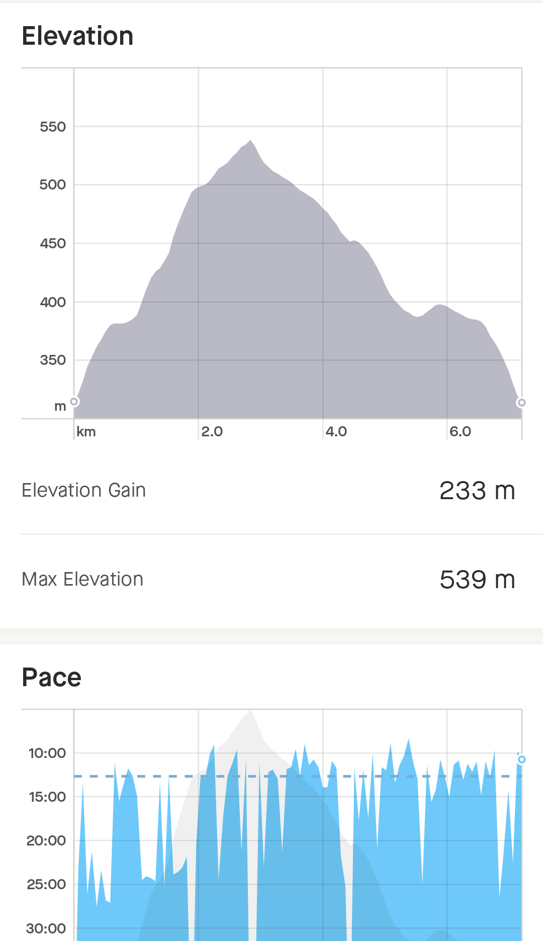
Huts or remains of.
Abandoned mining facilities 
Lake on the ascent.
This should be the first view of the summit. Nah... 
The summit approach, you should be able to see three towers here.
The Trig point, buried in a step on a mound.
Bit of an awkward swim.
Benchmark, two steps higher than the trig, but not as high as the observation platform.
Steve trying to find the driest route off the hill! To be honest, you should be able to see about 45 bmiles from here, not 30 yards.
It was a tad wet and blowy!

"Climbed it, climbed it, want to..."


We did find some shelter for a brief moment.
Before what hair we had was nearly blown away.
It stung.
Clee Hills had an unfortunate habit of eating low flying planes during WW2, both RAF and Luftwaffe. This memorial commemorates the ones lost on Brown Clee
Lots of ancient woodlands, these and massive moss growths.

Pretty stream too.
Some views below the good clouds too.
There was actually a view once you dropped below the clouds.
A great walk, we will return when the weather improves.
Not a value: Church Hill, Clows Top, Worcestershire. 04-02-2024 230m.
Walk technicality *
View ***
Company *****
Overall 10/10
Our route, a layby next to an old phone box (now defibrillator), a wander up the road, a climbable gate, a very interesting trackway up to a disused quarry. Sheep. A barbed wire fence with one portion cut out so a middle aged man on a silly quest could climb over with a light straddle, and a trig point standing tall in a field. Someone of the avian variety obviously dines frequently on top, as there was a huge amount of dehydrated bird pooh.
It's still swimmable though! 


One man and his trig point! 
Looking down into the quarry.
Honestly, the view was incredible.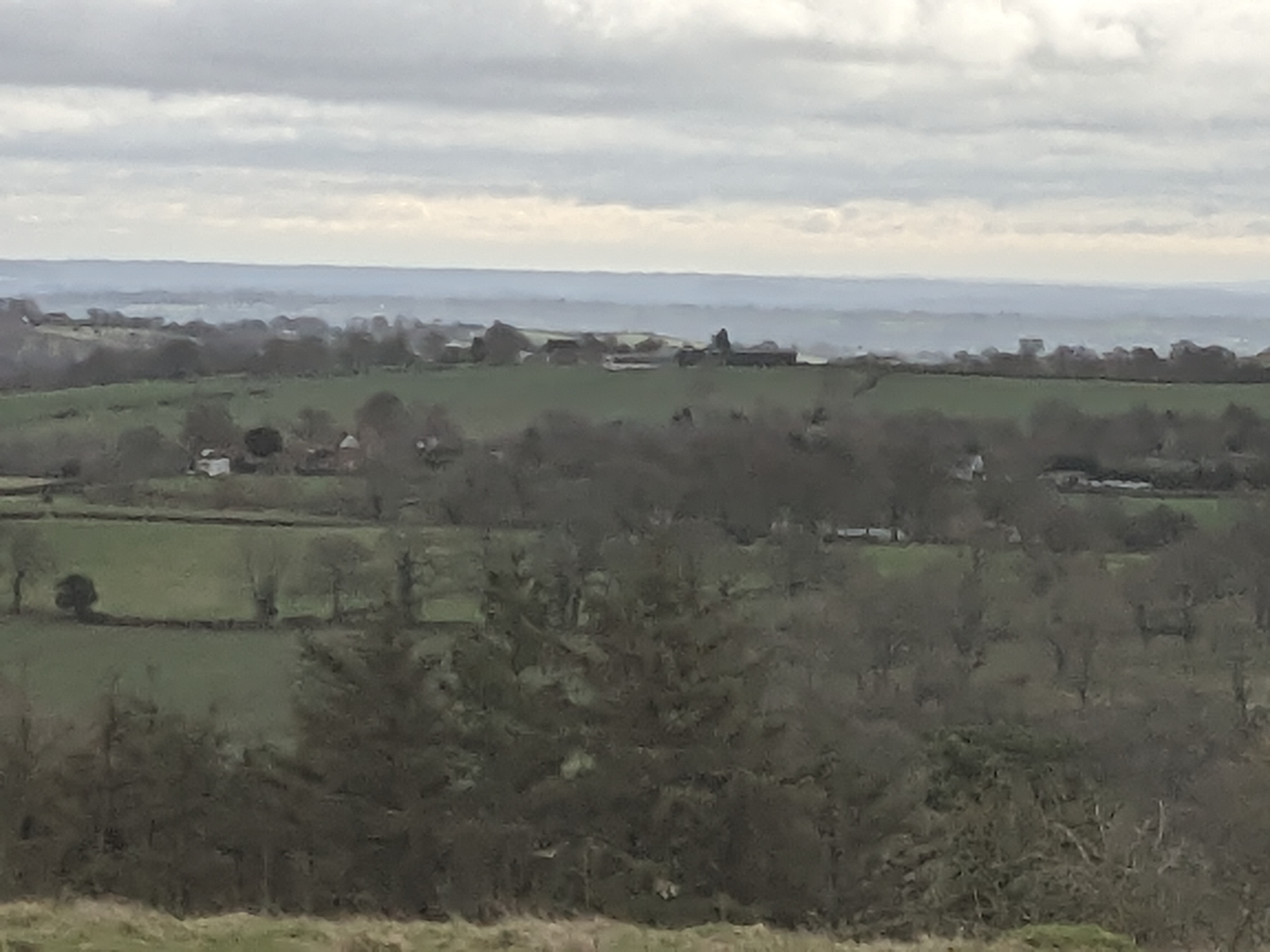
Superb view for a small hill.
Bench mark
Overall, a lovely half-hour walk and climb, and quite amazing views. To be honest, Church Hill was an absolute treasure to find, and completely quiet and beautiful. Would recommend it, it's short, but worth it. 600m of walking and 15m of climb. The quarry is obvious, and wooded all around, so no chance of plummeting in.
230m
It was so short, Strava hid 3/4 of the route! 230m, this would be higher than ten of the official country tops, including my first top of Arbury Hill in Northants!!
The aforementioned track feature and quarry. I wanted to know more! Why Church Hill, there are no churches nearby. Unless the quarry was used for an ecclesiastical building, maybe the natural amphitheatre had hosted services? I would love to know The track was certainly deeply defined, and looked well used in the past. The Trig point is top left, halfway between the corner and the quarry edge. But this gives you an idea of the scale of excavations.

15m of absolute pleasure to be honest! 
On the way back to Shrewsbury, it's not often you see one of these

Definitely not often you see one of these!
And really not often you see a £2 million pound water tower conversion either! Yes, I did stop the car to take this!
The view from my Dad's ward! The South Shropshire hills of my youth!
Not a value: Corndon Hill and Lan Fawr Powys.. 25-01-2024 314m-ish.
Walk technicality *** (+1 due to weather)
View *** (-1 due cloud base below the summit)
Company n/a
Overall 8/10
Due to being unavoidably detained in Shropshire while my Dad was recovering from an unexpected major operation, I needed things to do and occupy my over wrought mind. Thankfully, I had had the foresight to grab enough kit to walk on the hills, and it gave me a chance to pick off a hill that I had passed at least twice a week in my youth, but never been up.
Corndon lurks like a ruddy red tiger on the border, dominating the marches for at least ten miles in all directions. It's a hill that lurks in the background like a Neolithic tiger and broods ominously along the road between Shrewsbury and Bishop's Castle just over the border into Powys. Not often you get to play on an extinct volcano that produced highest quality stone axes that were transported to at least Kent and maybe the near continent.
The nearest settlement is the former lead mining hamlet of White Grit, named after the lead spoil. There is a decent nearby carpark for Mitchell's Fold Stone Circle and a good track that transects the two rises.
A side profile as I drove up.


2) Bardon Hill, Leicestershire 278m 26-10-2023
Walk technicality **
View *****
Company n/a
Overall 9/10
The last saturday as the clocks changed, in the gathering gloom of a post-wargaming day, in my new walking boots (Thanks Pin), just before the rain lashed it down, I decided to break my commute home to bag my second top and my first solo.
Conveiently close to the M1, on the way home from Boards and Swords, lies Leicestershire's highest point, the extinct volcano and granite outcrop that is Bardon Hill at 278m.
It nestles next to Coleville, with a rather attractive housing estate right next to a well marked path, which quickly moves into lovely mixed woodland and soon steeply rises.
A testament to the mining and quarrying history of the area are various carved way markers on the quarry side of the path. When I say quarry, I am used to a pre-industrial scrape in the ground, usually a small scar in a hillside, not an active granite super extraction! It's a bit impressive!


For a hill of 278m, it was rather pleasing to have done 278 feet of ascent. The track is literally up, turn round, back down, but for an evening stomp, it was perfect.


A great walk, and because of the views and location, probably one I would do again.
Mi Raisan de eater!
For the last few decades, after seeing a book in a long defunct gear shop in St Albans, I have thought about doing the 'County Tops'. These are the highest points in England and Wales. As there are 48 in England of them, I decided to do them between my 50th (last Tuesday), and my 54th in 2027.
48 - yup, there are 48 on the Wikipedia page. Many different guides have different numbers, but since I was born in 1973, I will do the county tops extant since then.
I have climbed some many times (Dunstable Downs), some a few (Scafell Pike) and some I have lived under but never done (Clee Hills). Annoyingly, I have done an awful lot of second highest peaks, such as St Catherine's Hill on the Isle of Wight! So, the list is started anew.
1) Arbury Hill, Northamptonshire. 225m. 07-10-2023
Walk technicality **
View *****
Company *****
Overall 10/10
They say you never forget your first. Hi there (Censored)!
I was in Daventry for a wargames competition (I didn't do that well), but I had asked the Whatsapp group of wargamers if anyone fancied joining me on a mad stomp, and the legend that is Graham Willmott said he would. So, after a hard day of throwing dice and pushing toy soldiers around, we primed a satnag, got in our cars and headed the five miles to Arbury Hill (a possible Iron Age hillfort), the highest point in Northamptonshire (by 1 metre) on a fantastic, warm, sunny autumnal evening.
Thankfully, I had done my research on this one as the hill is in private hands. We stopped off at the lovely Staverton Lodge, a busty working farm, where the landholder has their phone number posted, and called for permission. After setting a few (minor) ground rules (no litter and no dogs, and which fields did not have defensive cows with their calves), and checking how many of us there were.such as how many of us, we set off.
The walk was not at all strenuous with much chat about life and what we were both up to. Apart from one fence we had to climb, due to the gated route being in the cattle filled fields, which was a challenge for Graham's blue suede shoes. The top was soon approached and it looked amazing! You could really see the (possible) embankment line cut through by a motorcross track.
The summit was flat, rectangular area, with views all the way past Northampton to the East. You can see the cut through the embankment too. Honestly, it was fabulous. The views all round were brilliant, and it was a great 360 view, and teh company was superb too. 
The panorama from the top. Graham did a good job ducking out the way as I span round. 
The route. The summit is not actually marked on the ground, but there was definitely a slight rise that was above everything else (and looks like we hit it).
Stats, not as impressive as some that will come, but a really decent up for a short distance.
Comments
Post a Comment